John Ogilby Map 'The Extended Road from Oakham to Richmond'
Dealer Contact Info
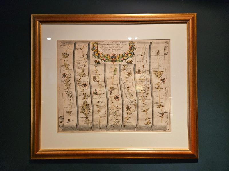
<p>A print from a strip map of "The Extended Road from Oakham to Richmond," created by John Ogilby in 1675, c.1800. It is part of the first comprehensive road atlas of England and Wales entitled "Britannia". The original map was engraved on copper plates to allow intricate detail to be added before printing. The map is composed of multiple vertical strips, each representing a segment of the road with detailed illustrations of key landmarks, which is typical of Ogilby's work. This map covers the road from Barnsley to Richmond (Yorkshire), detailing the route through several notable cities such as Halifax. More information on this series of maps can be found on the <a href="https://www.davidrumsey.com/luna/servlet/detail/RUMSEY~8~1~278461~900513... target="_blank">David Rumsey Map Collection website - click here</a>. Measures 26.5" wide x 23.5" high including frame. Stock number CS371.</p>